Agua Volcano
Agua Volcano
Located 9 km from Antigua Guatemala, Agua Volcano rises to 3,766 m. An inactive stratovolcano steeped in history, it offers an ascent of approximately 6 hours.
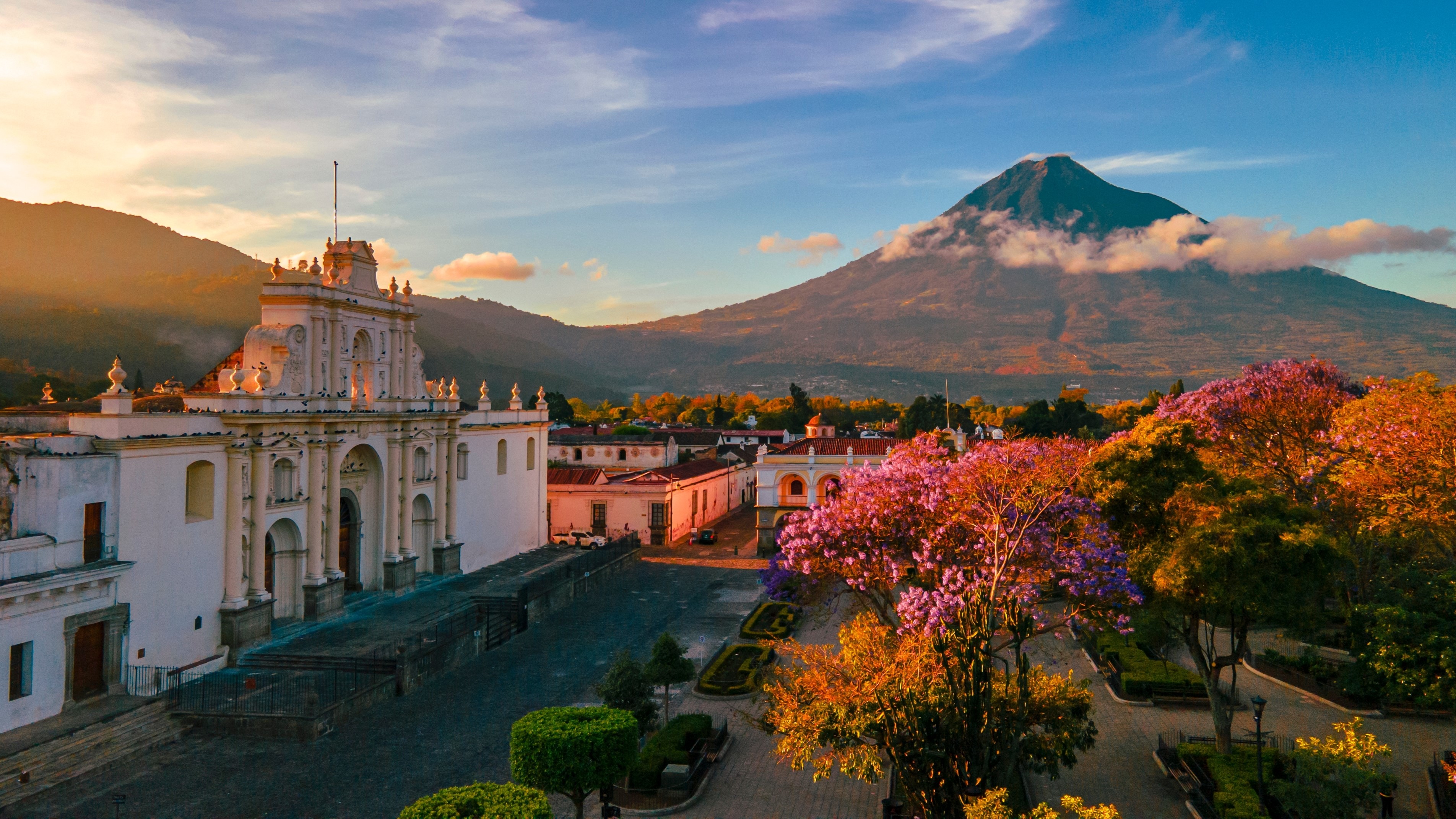
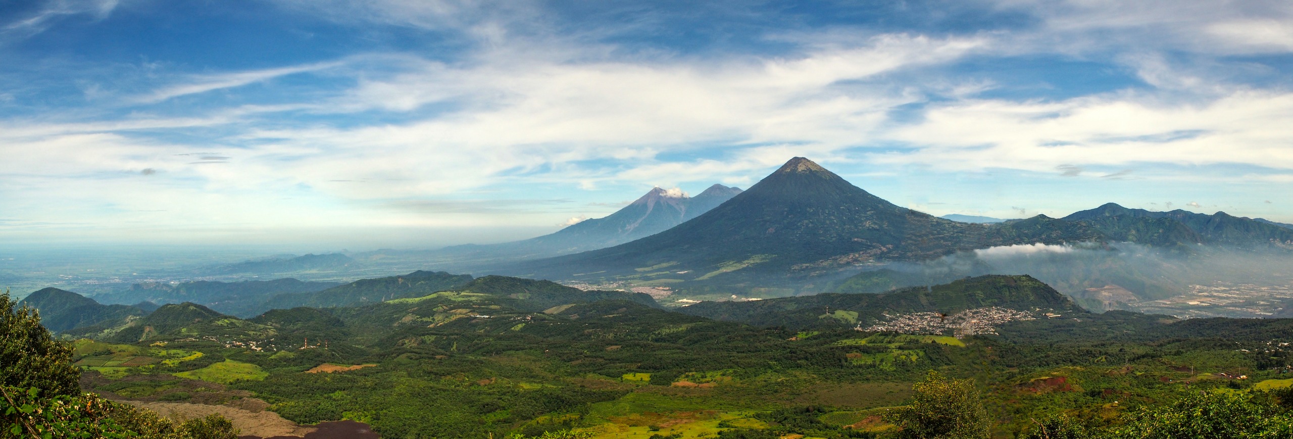
Agua Volcano rises in a conical silhouette south of Antigua Guatemala, peaking at 3,766 meters. This stratovolcano, considered inactive, shapes the landscape of the Central Highlands and represents one of the most accessible climbs in the country from the colonial city.
Why visit Agua Volcano
Three main reasons draw visitors to this summit located between the departments of Sacatepéquez and Escuintla:
- A regular and symmetrical silhouette that dominates the panorama of Antigua Guatemala, listed as a UNESCO World Heritage site.
- A day-long ascent achievable from the village of Santa Maria de Jesús, with no need for overnight camping.
- Complete vegetation zoning, from tropical plantations to high-altitude conifers, observable in a single day's hike.
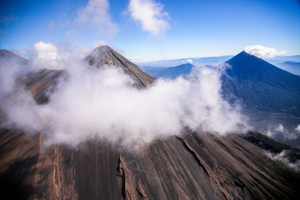
The summit hosts a concave zone where water concentrations persist, along with telecommunications installations. On clear days, the view extends to the neighboring Fuego and Acatenango volcanoes.
The history of Agua Volcano
In Cakchiquel tradition, the volcano was named Hunahpú. Its neighbor, Fuego Volcano, was called Chi Gag—a name still used today by indigenous communities due to its constant eruptive activity.
On September 11, 1541, a massive mudflow and debris torrent (a lahar) swept down the volcano's northern flank and destroyed the Spanish capital of that era, Santiago de los Caballeros, founded at the summit's base. The catastrophe triggered the relocation of the city to Ciudad Vieja, and later, following further earthquakes, to the valley where Antigua Guatemala stands today. Following this event, Hunahpú was renamed Agua Volcano.
Though classified as inactive, the volcano remains capable of generating debris flows, as evidenced by its current morphology.
What you will see
The summit crater
The crater presents a concave zone where rainwater accumulates. In aerial photographs, three parallel ridges extend from the north-northeast edge down the cone's slope, separated by two small channels. This configuration suggests that a portion of the crater collapsed in the past and that the rim was once higher.
Secondary craters
On the northwestern flank, approximately 4 km south of Ciudad Vieja, six small craters align from north-northeast to south-southwest, just below the upper vegetation limit. They testify to ancient secondary volcanic activity.
Vegetation zoning
Progress along the slopes crosses several strata:
- At the volcano's base: sugarcane plantations, followed by coffee and corn fields.
- Beyond 2,600 meters: high-altitude tropical forest.
- Around 3,000 meters: highland prairie dotted with conifers, dominated by pines to the summit.
How to reach Agua Volcano
The ascent's starting point lies in the village of Santa Maria de Jesús, located approximately 9 km from Antigua Guatemala, in the municipality of the same name.
- From Guatemala City: paved road to Antigua Guatemala (54 km).
- From Antigua: asphalt road toward Santa Maria de Jesús, accessible by taxi, shuttle, or local bus (chicken bus).
From the village, the trail crosses the road several times, leading to the La Olla refuge at the midpoint.
Practical information for the ascent
- Duration: approximately 6 hours uphill, plus the descent.
- Difficulty: demanding hike due to continuous elevation gain and altitude.
- Safety: authorities recommend planning the ascent with the tourist police (POLITUR), who can accompany groups.
- Equipment: ankle-supporting hiking boots, warm clothing for the summit, windbreaker, headlamp, plenty of water, energy snacks.
- Departure: early morning to avoid heat in the lower sections and descend before nightfall.
When to go
The dry season, from November to April, offers the best conditions: infrequent rainfall, mild temperatures, and clear visibility from the summit. To avoid crowds, especially during year-end holidays and Semana Santa, favor the November to January window while avoiding public holidays.
Always check local weather the day before your ascent: high-altitude clouds can obscure the summit view even in dry season.
What to see nearby
Antigua Guatemala, roughly ten kilometers away, concentrates the majority of sites of interest:
- The Plaza Mayor and San José Cathedral with its colonial ruins.
- The San Francisco El Grande church and Santa Clara convent.
- The Palace of the Captains General and Town Hall.
- The Museum of Ancient Books and the Social Works of Friar Pedro.
- The Alto trails and Finca El Pilar for a half-day hike.
Hikers will extend their stay with the ascent of Acatenango and Fuego volcanoes, immediate neighbors of Agua Volcano offering views of active lava flows. For another perspective on Cakchiquel culture, the archaeological site of Iximche lies approximately one hour's drive away.
Frequently asked questions
Frequently asked questions
Plan for approximately 6 hours uphill from Santa Maria de Jesús, plus 3 to 4 hours downhill. The hike is completed in a full day, with an early morning departure recommended.
A guide is not mandatory but strongly recommended. Tourism authorities advise planning the ascent with the tourist police (POLITUR) or through a local agency for safety and navigation reasons.
The ascent is demanding: significant elevation gain on continuous trail, final altitude of 3,766 meters that can cause breathlessness. Good physical condition and mountain hiking experience are necessary.
The volcano is considered inactive. Primary risks stem from altitude, changeable weather conditions, and historically, incidents in isolated trail zones—hence the recommendation for accompaniment.
November to April (dry season), with preference for November to January to avoid peak tourist periods.
Prepare your ascent
Agua Volcano fits naturally into a circuit around Antigua Guatemala and the Central Highlands. To build a comprehensive itinerary combining volcanoes, colonial sites, and Mayan villages, consult our customized trips to Guatemala.
Interested in this visit?
We can include it in your personalised itinerary.