Tikal
Tikal
In northern Guatemala, Tikal comprises more than 3,000 Maya structures within a jungle spanning 576 km². Practical guide: temples, access from Flores, season and FAQs.
In northern Guatemala, in the forested region of Petén, Tikal encompasses more than 3,000 Maya structures spread across approximately 16 km². A former capital of a powerful kingdom, the site has been inscribed in UNESCO's World Heritage since 1979 and ranks among the major archaeological complexes of the Americas. Visits are typically based from Flores, a hub town located roughly 64 km away.
Why visit Tikal
Tikal brings together several rare characteristics: a Maya city of great scale, a 576 km² national park that surrounds it, and visible wildlife among the ruins. Spider monkeys, green parrots, coatis and, more discreetly, pumas and jaguars inhabit the canopy. The pyramids rise from giant ceibas and kapoks, which makes the perception of the site quite different from that of a cleared site like Chichén Itzá. It is also a privileged vantage point at sunrise and sunset, from the summit of several temples accessible to visitors.
History of the city
The city was likely founded in the 4th century BCE and fully developed during the Classic Maya period. By the 4th century CE, Tikal had come under the influence of Teotihuacan, the great metropolis of the Valley of Mexico, though it continued to grow. The city was subsequently abandoned toward the end of the 10th century, amid prolonged droughts and regional upheavals that affected the entire Maya lowlands.
At the height of its influence, Tikal is believed to have had approximately 90,000 inhabitants. The city was ruled by at least 33 kings, a dynasty founded around the 1st century by Yax Ehb'Xook. Several royal burials have been identified on the site.
Etymology: Yax Mutal and "water hole"
The modern name Tikal first appears after the site's rediscovery in the 1840s. Its ancient name was Yax Mutal (or Yax Mutul), commonly shortened to Mutul. According to a widespread etymology, "Tikal" derives from Yucatec ti ak'al, meaning "at the water hole," referring to the reservoirs built by the Maya. Another interpretation, in Maya Itza, translates the term as "city of voices" or "place of languages."
What to see on the site
The ceremonial center concentrates around the Plaza Mayor (Grand Plaza), bordered by temples and acropoles. One day allows you to see the main buildings; two days offer a more complete understanding, including peripheral groups.
Temple I — Temple of the Great Jaguar
Standing 47 meters high and structured in nine tiers crowned by a roof comb, this pyramid is also called the Temple of Ah Cacao. It closes the Plaza Mayor to the east and appears on the reverse of the 50-centavo Quetzal banknote. It is Tikal's most widely circulated image.
Temple II — Temple of the Mask
Facing Temple I on the west side of the Plaza Mayor, Temple II was dedicated to Lachan Unen Mo', wife of the ruler Jasaw Chan K'awwiil. Its name comes from the queen's portrait carved on the lintel at the summit of the structure. Both Temples I and II date to around 700 CE.
Temple IV — Temple of the Two-Headed Serpent
At 65 meters tall, Temple IV is among the tallest known pre-Columbian structures in the Americas. From its upper platform, you can see the peaks of other temples rising above the canopy — a panorama particularly prized at dawn and dusk.
Acropoles and secondary complexes
The North Acropolis and Central Acropolis, on either side of the Plaza Mayor, concentrate stelae, altars, and elite residential buildings. The site also includes pyramidal complexes, causeways (sacbés), and numerous carved stelae scattered throughout the jungle.
Site museums
Two museums complement the visit:
- Sylvanus G. Morley Museum: funerary objects, jade, and ceramics from royal burials.
- Stelae Museum: stelae and carved fragments preserved indoors.
Tikal National Park
Founded in 1955, Tikal National Park protects 576 km² of tropical forest. Vegetation long covered the city before the first excavations. The great ceiba (sacred tree of the Maya), tropical cedar, and kapok are commonly seen, often frequented by green parrots. Wildlife also includes spider monkeys, howler monkeys, pumas, and jaguars, the last two being rarely spotted.
Practical information
The site opens early in the morning and closes in late afternoon. Special tickets, sold as a supplement, allow entry before dawn or stay for sunset. Prices are quoted in Quetzals and change regularly: plan to bring cash, as there are no ATMs on site. Tickets are valid for one day; those purchased in late afternoon are generally extended to the next day.
What to bring: water (1.5 to 2 liters per person), hat, sunglasses, sunscreen, insect repellent, closed-toe shoes, and a headlamp if you plan an early sunrise entry. An English-speaking or Spanish-speaking guide, hired at the entrance, greatly enhances the visit.
When to go
The dry season, from October to May, remains the most comfortable period: trails are passable, skies are often clear at sunrise, and morning mists over the canopy are very photogenic. From June to September, showers are frequent but vegetation is denser and crowds are smaller. Plan for 4 to 6 hours minimum, ideally a full day.
How to get there
The classic starting point is Flores, approximately 64 km away. Shuttles and buses connect the town to the site in about 1.5 hours, with a stop at the park entrance to buy tickets. From the Belize border (Melchor de Mencos), a collectivo reaches Tikal in approximately 2 hours. Travelers with time to spare can also stay in one of the hotels located at the park entrance, making sunrise access easier without an early morning drive from Flores.
What to combine in the region
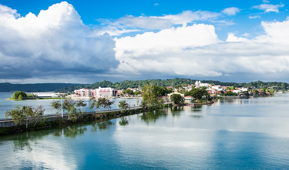
- Flores — island town on Lake Petén Itzá, logistics hub for Tikal.
- Cahabón River — whitewater descent south of Petén.
- Iximche — another Maya site in the highlands.
- Acatenango and Fuego Volcanoes — volcanic hike near Antigua.
Frequently asked questions
Frequently asked questions
Allow a minimum of 4 to 6 hours for the main temples and Plaza Mayor. To explore peripheral groups and museums, plan for a full day, or even two days.
Both options have merit. Sunrise from Temple IV offers soft light and a canopy often shrouded in mist. Sunset is more logistically accessible from Flores. A supplemental ticket is required to enter before dawn or remain past closing time.
No, the site can be visited freely, but a guide transforms your understanding of the buildings: dynasty, hieroglyphics, ritual functions, and wildlife. English-speaking and Spanish-speaking guides are available at the entrance.
Yes, a few hotels are located at the park entrance. This is the most convenient option for witnessing sunrise without an early morning drive from Flores.
Yes, the site is open every day. The dry season (October to May) remains more comfortable; during the rainy season, trails can be slippery but vegetation is spectacular.
Prepare your trip
Tikal fits naturally into an itinerary combining Petén, Maya highlands, and the Pacific coast. To build a custom route including Tikal and other sites in the country, consult our Guatemala trips.
Interested in this visit?
We can include it in your personalised itinerary.